

My third sojourn along Network Rail’s London based ends of the line. But “hang on” I hear you say, “Rainham isn’t an end of the line!” Indeed not, the line out of Fenchurch Street, managed by c2c has three services terminating at: Grays; Southend Central and Shoeburyness.

Today I’m travelling along the Grays service as far as I can using my London Senior Citizens travelcard which allows me access to all the stations within the Transport for London (TfL) travel zones. This is part of my definition of my second series of ‘the end of the line’. I hope that helps?
The Station
The station, perched on the fringes south of the village of Rainham, is an open station with distant views of the railway lines extending as far as the eye can see in both directions. Served by a single platform on either side of the track which can be accessed either by a footbridge, or by a barriered level crossing accessed from outside the station.

It’s not a place to hang around for too long, but long enough to appreciate that the area is a mix of residential dwellings, marshland, and industrial space, each with their own stories to tell.

Adjacent to the station is the high speed rail service from London to the continent via the Channel Tunnel, and I was able to see them passing at an incredible speed. There’s a new footbridge and ramp over this line, which is where today’s picture of the day comes from (see below), and the footbridge has been extended to cross over Ferry Lane giving direct access to the Marshes.
The Marshes
My encounter with the marshes begins after I’ve navigated my way under the A13’s elevated viaducts. Although there is a footpath on both sides of the road, they have been eroded and are now full of deep potholes courtesy of the lorries who seem to use them as a temporary parking spot whilst they wait for word that they can progress to the nearby recycling centres.
The view under the viaduct has a somewhat ‘Holywood’ feel to it. One where you’d expect either a car chase to be taking place or where the bad guys and the good guys meet in a blaze of gunfire. Maybe that’s why it’s fenced off…?

I start my walk besides Ferry Lane headed towards The Thames along a somewhat overgrown footpath on the edge of the Marshes. It seems the name Rainham Marshes is synonymous with the RSPB Nature Reserve which manages over 1000 acres (411 hectares) of ancient, low-lying grazing marsh; a complex of wet grassland and ditches, grassland and scrub. The area I’m walking through certainly matches this description.

There are varied views across the marshes and an intriguing footpath sign that piques my interest to follow the path. This one offers directions to: the RSPB Nature Reserve; the Three Crowns; and the Concrete Barges and it’s certainly enough to entice me to follow it to the Three Crowns, without knowing what this is?

Views as far as the traffic laden Dartford Crossing, some 7.5 km as the crow flies, can clearly be seen in the distance. And the swathes of bulrushes and cow parsley, some standing at least eight feet high like titanic guardians of the marshes, are a sight to behold.

The Thames
The river is never far away, and the road that leads from Rainham to the river is appropriately named Ferry Lane, no doubt as there were several ferries that once operated from here. And despite various internet searches leading to some historical reports, it remains unclear as to exactly where the ferries landed.

A plaque unveiled in 1999 on the defence wall overlooking the river declares 800 years of passage across to Erith in Kent, probably carrying passengers on their Pilgrimage to Canterbury. Records also reveal there was a ferry stopping point here for travellers between London and Gravesend; this service eventually declined in the mid 19th Century with the coming of the railway. There’s also a suggestion that the Margate paddle steamer stopped here around the same time too.
Not surprisingly, there was a pub at this point. It was named The Ferry, but renamed The Three Crowns, and hence the direction marker found earlier on my trail. Alas, I found no evidence of the building and it seems it was demolished in 1972. But regardless, it’s been interesting exploring this part of history and my thanks goes to British History Online for helping me with this research.
I spend some time walking along the very overgrown Thames Loop footpath. There’s clear evidence of a proper footpath underfoot, but I suspect it’s been a long long time since it saw regular walkers. Nevertheless, it gives me an opportunity to admire a different part of the river. I peer over the sea defence wall and see that the tide is out and the mudbanks are on full view showing off the many creeks breaking up the mudbank’s smooth surface as they meander into the river.

I head over to a natural headland and discover the Tilda factory, where presumably the packaged rice is produced. Interestingly along my travels, I saw a car with the number plate T1LDA. I’m drawn by their massive silos which stand in a regimented line as if acting as their own sea defence.

Without being close up, it’s difficult to appreciate the scale of their operation, and why they have their own pier stretching out into the river, although it’s not clear whether this is now being used.

I decide to turn back and retrace my steps to head into Rainham, which is a walk, at a decent pace, taking me about 40 minutes. I now realise had I walked a little further from this point, I would have reached the Concrete Barges – ah well, maybe next time, but in the meantime have a look at the information from the London Riverside BID’s website that explains their presence and purpose.
The Village

As I return into the village over the level crossing, I notice a helpful walker’s guide to local places of interest on the side of the station and decide to end my day heading over to Ingrebourne Hill to explore what it has to offer. But first, I set off to explore the village.

Home to Rainham Hall, a stone’s throw from the station, this National Trust property, along with many other of their locations, is closed as part of the Trusts approach to ensuring the spread of Coronavirus is prevented. A shame, because as a member I could have had a look round for free.
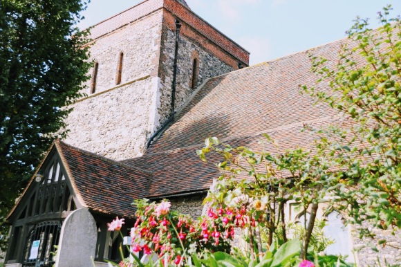
The Hall sits in it’s own grounds and gardens, walled off from the adjacent St Mary & St Peter’s church. Reportedly this is the oldest building in Havering dating back to 1170 and built by Richard de Lucy, Henry II’s son-in-law and, as it turns out, he was one of the instigators of the assassination of Thomas Becket (aka Thomas à Becket). An internet search of the church reveals several sites exploring the building’s construction.
It’s a small village consisting primarily of two roads that converge by the church and a recrafted clocktower and war memorial: they are Bridge Road and Upminster Road South.

There’s clearly character in the village’s architecture, but now somewhat spoiled by the shop fronts carved into the rows of small cottages. I sense the village has been dwarfed by the nearby Tesco superstore, and consequently I suspect the local traders struggle to get by. There are some local residents out and about, but sadly, those I encountered were in small groups drinking openly in public places giving the impression this is a somewhat deprived area of Havering.
Ingrebourne Hill
I end my day’s walkabout here; it’s about a mile north of the village. I’m drawn by the road signs inviting me to follow them, and I’m not disappointed. The area is open land managed by Forestry England and one that leads into other parklands. From here you can reach Hornchurch Country Park, Gaynes Parkway and Hacton Lane Park following the river Ingrebourne and eventually emerging near Upminster.
A former sand and gravel quarry, the area has been sympathetically regenerated into a country park with views that stretch in all directions from the top of the hill. South towards the Thames and into Kent; and north along the Ingrebourne Valley, home to London’s largest remaining continuous freshwater reed bed, designated as a Site of Special Scientific Interest (SSSI) and a Local Nature Reserve.

As I turn to go back down the hill, I see a painted stone placed on a bench that would give those sitting down a view over the Thames and beyond. The stone is brightly coloured and has the inscription ‘Psalms 8’. I follow the lead and having read the Psalm, I now understand why it has been placed here. There are several versions, but all with the same meaning…go look it up.
Picture of the Day – Shadows

Nature is a wonderful thing, especially when it’s seen in black and white, and today’s picture was exciting and delightful to capture.
The sun streaking through the railings at the base of the footbridge over the high speed line gave these stark shadows. Not only accentuating the geometric shapes as the sun shines through, but also giving rise to this powerful shadowy effect. There’s also a hint of a sunlit gap paving the way to the staircase beyond that almost invites you to walk along it.
- Location: Rainham Station
- Date/Time: Thursday 22nd September 2020
- Settings: Camera – Canon EOS 200D; Aperture – ƒ5.6; Shutter Speed – 1/200; Focal Length – 63mm; Film Speed – ISO320
Social Media
If you like what you see, do please follow me on my social media channels
- YouTube – for my video clips where I present a compilation of my day’s pictures to music
- Instagram – for my photo portfolio where you get to see pictures of each visit before I publish my blogs
- Facebook and Twitter
